Upper Coroico Road (between
La Cumbre and Pongo)
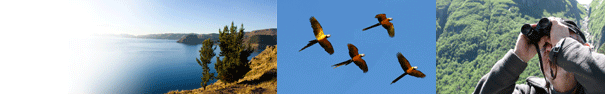
by Lawrence Rubey and A. Bennett Hennessey
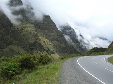
If the siren call of the cloud forest (Cotapata Trail and Chuspipata) is not too great or you have couple days for the Coroico Road area, the Upper Coroico Road between La Cumbre (almost 4,600 meters) and the small village of Pongo (3,800 meters) offer interesting birding, with the emphasis on several high altitude specialties. One can stop anywhere along the road and enjoy the dramatic scenery, but three stops, coming in fairly fast succession, are particularly worthwhile. Even if you only spend 30 minutes at each site, you have a good chance of spotting some interesting birds.
Four km from the Cumbre, the road makes a sweeping turn to the right. On the left side of the road, there is an interesting boulder field, a steep mountain face, and a small stream (Stop #1). White-winged Diuca-Finch are quite common, but check closely for a Short-tailed Finch lurking in the boulders. Any flowering plants are worth staking out as Oliveceous Thornbill may be seen. Across the road is a small bog that can have finches foraging on the ground.
At 9.0 km from the Cumbre, a road-side bog with scattered boulders is attractively situated on the left-side of the road (Stop #2). With an altitude of nearly 4,200 meters, this is an excellent site for Streak-throated-Canastero especially if you spend time walking among the bogs and boulders. Watch also for Blue-mantled Thornbill. Short-tailed Finch is difficult to see, but the superficially similar Plumbeous Sierra-Finch is common. To check out a small pond that sometimes has waterfowl, walk east uphill a hundred meters or so. By parking on the left-hand shoulder of the road, you should be able to scan the entire area and decide which sections need further exploration on foot.
As you continue to descend the serpentine Coroico road, roadside vegetation increases. At 12.9 km, there is an unmarked track that joins the road on the left-hand side. Turn left and enter a large gravel clearing (Stop #3). The hillsides have quite a bit of indigenous vegetation and a small stream flows by, crossing under the paved road. This area is very reliable for Tawny Tit-Spinetail and Scribble-tailed Canastero. Stripe-headed Antpitta has also been seen on the boulders further up the ravine. The altitude at this stop is about 3,800 meters.
Logistics: Leave La Paz via the neighborhood of Miraflores, taking the road to Coroico. Pass though the Miraflores police tranca and continue for 16 km to the Cumbre (see Site 5: La Cumbre). At the Cumbre, re-set your odometer to zero (0.0) and begin the descent. The three stops described above are at 4.0, 9.0 and 12.9 km respectively.
GPS reading at Upper Coroico Road Stop #1: S 16 19.084' W 68 02.201'
GPS reading at Upper Coroico Road Stop #2: S 16 19.078' W 68 01.390'
GPS reading at Upper Coroico Road Stop #3: S 16 19.741' W 67 57.981' |